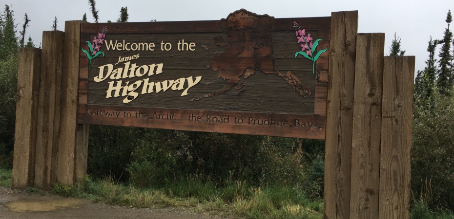
After dropping the gliders (hang and para) and the harness bags at a friend’s house for safe keeping (Thanks to Amy and Garrett!), we set out to conquer the famous James W. Dalton Highway. The Dalton connects Fairbanks to Prudhoe Bay, the farthest ‘driveable’ point to the north in North America. Some of you may remember that Jorge and I drove to the farthest southern point in the US (the tip of Key West, FL) two years ago, and the farthest northern point in South America (Punta Gallinas in La Guajira, Colombia) last summer.
While some people might recognize this highway’s name from Ice Truckers (Jorge has watched, but not me!), this road is much more than one of today’s reality TV shows. Built in the 70’s to facilitate the construction of the great Alaskan pipeline, it is a 414 mile stretch of mostly dirt/gravel road – only about 100 miles are ‘paved’ – if you can call it paved…pitted with frost heaves, potholes, residual calcium chloride, and rocks. A lot of rocks.
We were delighted in the way that any kid setting out on her first real adventure would be. You know, the time you got dropped off for your first overnight, the first time you saw the Grateful Dead, the first time you set out for the Arctic Sea…
We tried to capture the drive in photos for you. You can see that the views from the first mile of the Dalton to Atigun pass to the arctic tundra were magnificent. We couldn’t possibly write the description more accurately than the photos express.
It took two days to complete the first half of the trip to Galbraith Lake. With road conditions like this, driving at a consistent 40 miles each hour, it takes time. We passed a few hearty travelers on bicycles and motorcycles, other travelers like us, one or two giant motor homes…not sure how far they actually made it up the highway, and truckers. Yes, being passed on a narrow portion of a winding stretch of gravel road in the rain in the middle of nowhere by an eighteen-wheeler gaining his traction to make it up the next hill is humbling, to say the least. The first time it happened, we were slightly intimidated. We had read about this phenomenon in the MilePost, but couldn’t really imagine that they would pass us! We diligently slowed down and pulled slightly to the right when we saw them coming. Why would we not pull all the way over to the right? The shoulders are almost non-existent, and when they are available you have to be extra careful because they will suck you into the loosely packed gravel and deposit you right into the tundra.
The day was rainy and socked in when we started out, but soon the clouds lifted and the sky opened. It was a glorious day for this drive. The pipeline does make for a soothing companion as you navigate the twists of the road. The pipe looks much smaller than one would expect, and in many places, you can walk right up to it. Passing one pump house after another, we read about the history of the pipeline, the scientific research centers and wildlife of the area.
Travelers are tourists, you know, and we could not resist the opportunity to have our photos taken at the Arctic Circle – 66o33’latitude. You can see our northern and southern crossings in the photos. The Arctic Circle host was kind enough to take pictures on one side of the line, passing the line, and arriving at the other side. Of course, we had to snap a few pictures of the truck there, as well. After all, the truck is doing most of the work to get us to the Arctic Ocean…
Just outside the Arctic Circle, you find the only gas available in the middle of the Dalton at Coldfoot Camp. Coldfoot was an original gold rush camp in the early 1900’s. Yes, the gold rush pre-dated the pipeline. We ate a yummy hamburger and bowl of chili here, had a Copper Creek Amber Ale, filled up the tank, and mailed another post card to the little kids. The people at Coldfoot Camp were incredibly kind. In the middle of nowhere we found people who cared about others.
It was on to Galbraith Lake that night. The most beautiful wild camping spot so far – located right in the middle of the tundra. The actual tundra. The sky was still filled with light until well after midnight. We savored the view, and slept in the back of the truck rather than our cozy Tepui. We knew we had a very early start the next morning to make it to the sea (…you have to go to the actual ocean in a bus because access is restricted at the oil fields). We had been told that the construction delays near Deadhorse could be as much as two hours, and we wanted plenty of time. It seemed like a good idea to hasten the morning departure by sleeping on the bed inside the truck canopy. Suffice it to say, the roof top tent is like a condominium compared to the canopy. It felt like sleeping in a coffin…won’t be doing that again unless it is absolutely necessary! It rained much of the night and we awoke to the tundra completely enveloped in fog. A quick cup of coffee/tea and we were on our way to Deadhorse and the frigid arctic sea. (Will, that JetBoil may be the most favorite item we have with us on this trip!)


I am loving all of the photos and the great stories. Thank you for sharing your adventure.
LikeLike